We’re
1,107 miles from home and still on I-80.
The Route
This was our third day on I-80.
We drove east for 323 miles.
Rawlins, Laramie and Cheyenne, WY and Sidney, NE were the only cities of
significant size.
About the Day
Clouds hung low most of the day, there were a few light rain showers,
20 mph winds in Laramie and dense fog in the mountains. The temperature dropped to 37° near Sherman
Summit, stayed below 50° in Wyoming and warmed to the low 60s in Nebraska.
Leaving Rawlins
Last night’s campground …
 |
| This land appeals to cowboys and hunters. |
 |
| The wind blows constantly. |
We got on the road by 9:45.
Along the Way
Highway communication …
I-80 (at least in Wyoming) is pretty dynamic. Speed limit signs are digital, electronic traveler
messages are well-placed and highway closure barriers can be activated remotely.
 |
| Barriers (like train crossing barriers) block the highway when they close a section. |
Wyoming Scenery …
 |
| Low clouds |
 |
| Snow fences line the highway. |
 |
| Wind farms are energized by constant winds. |
 |
| Aspen bring color to the area. |
The Fog …
We began the climb to the 8,640' Sherman Summit a few miles east of Laramie. Fog increased as we approached the summit.
 |
| A fog warning at work. |
 |
| We drove through this for about 12 miles. |
 |
| A welcome sight after escaping the fog. |
Nebraska Scenery …
 |
| This coyote caught our attention. |
 |
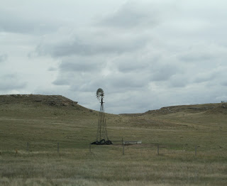
| Nebraska terrain presents a new look. |
 |
| Cabela's stands out in Sidney. |
 |
| Nebraska fields and ranges are more colorful than we saw in Utah and Wyoming. |
Did You Know?
Ogallala first gained fame as the terminus for cattle drives from
Texas to the Union Pacific rail-head located there.
The town’s name comes from the Oglala
Sioux tribe.
The Campground
We’re staying at Country
View Campground. It’s OK.
Tomorrow
Our next stop is in Lincoln, NE.


No comments:
Post a Comment