Thursday, August 31, 2017

Day 25 – Page, AZ (Day 2)

Some days just don’t turn out as imagined.

The Route
We drove 102 miles on US-89 and US-89A as we made a round trip to Lee’s Ferry.

About the Day
The temperature reached 88° on a sunny, breezy day.  As has become a regular event, a squall moved northeast across the area and passed north of Page in the early afternoon.


We came to the area to see The Wave and Horseshoe Bend.  It didn’t happen because we didn’t understand what it would take to get there.  Access to The Wave requires a permit issued by the Bureau of Land Management on a lottery basis and a 5.2 mile hike.  Access to Horseshoe Bend involves a 1.2 mile hike.  We’ve included a few pictures taken by others so you can see what we had in mind.

Getting Started
We started off by having breakfast “where the locals go” … at Ranch House Grille.  They offer a fun menu and very good food.  It was a perfect way to start the day.

On the Way
Lake Powell

Glen Canyon Dam
Glen Canyon
This "beehive" formation looked
like part of the power system.

Horseshoe Bend
It's quite a hike to the river.
The hike is up hill both ways.
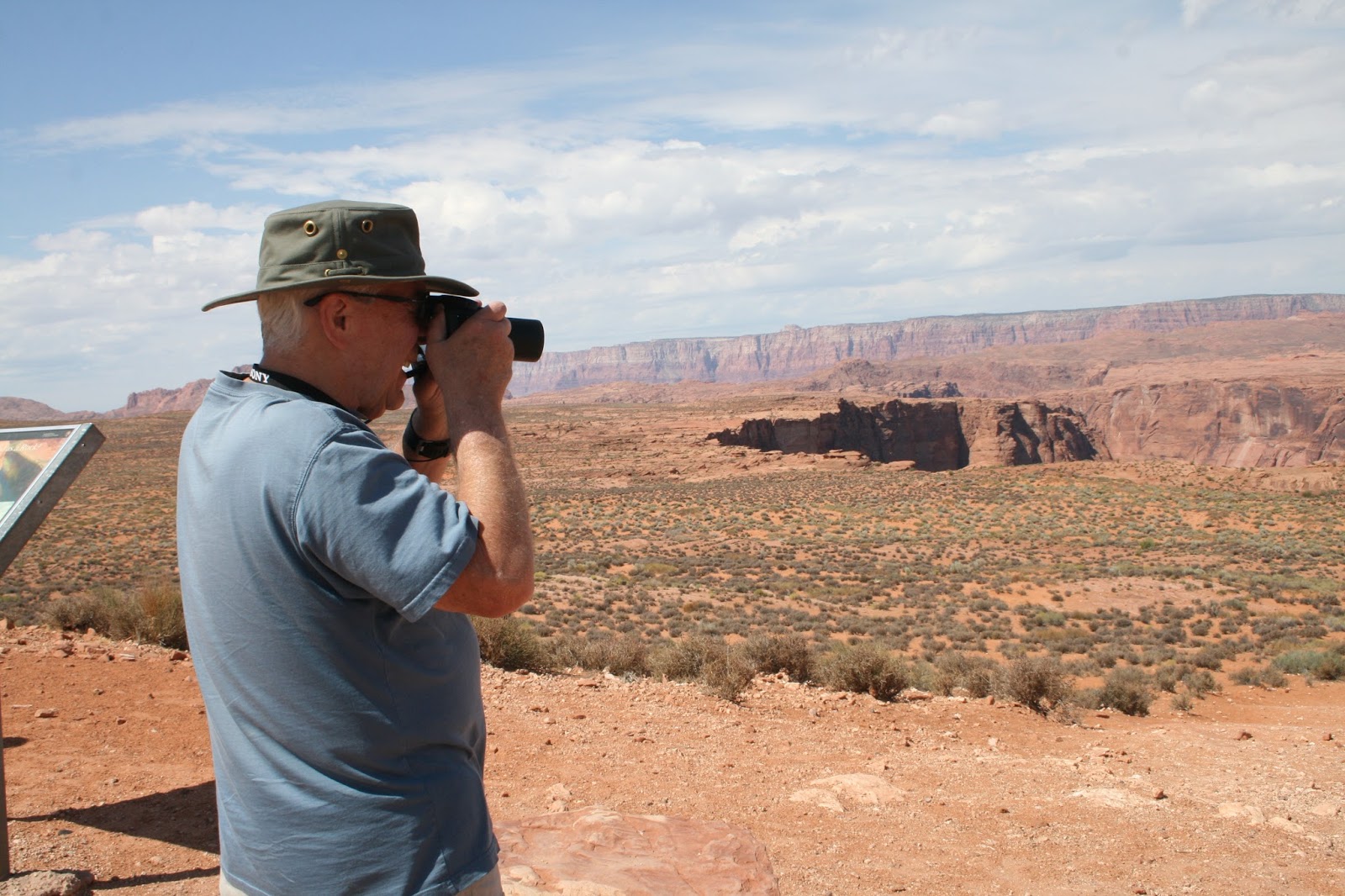
We looked really hard from the hill top.
And got a closer view of the overlook.
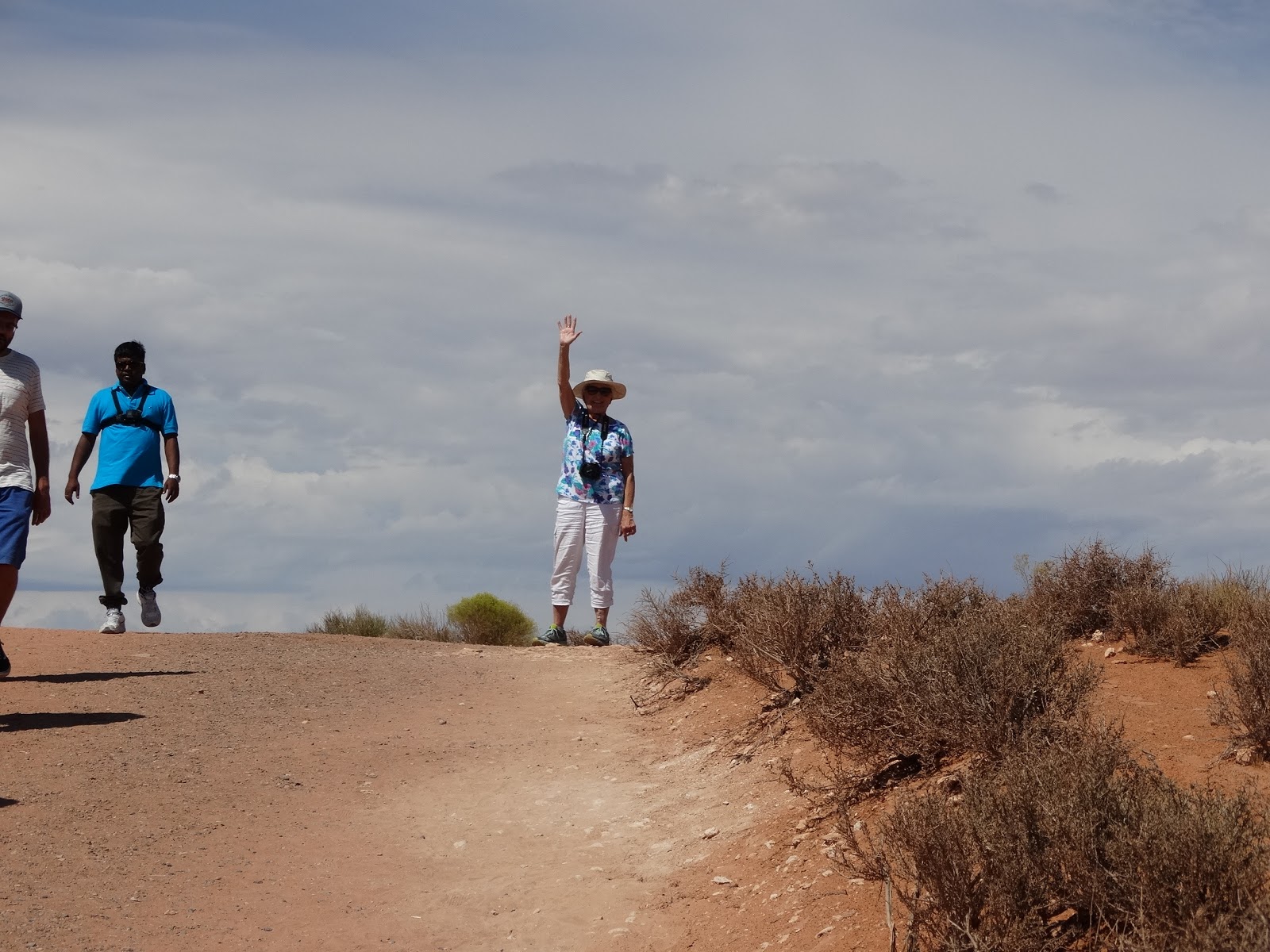
Carol at the top of the hill.
Lots of people come to see.
The reason we came.

Lee’s Ferry …
It's the only place for hundreds of miles where you can easily access the Colorado River from both sides.
Upstream
Downstream

Cliff Dwellers …
They sure had sturdy housing.
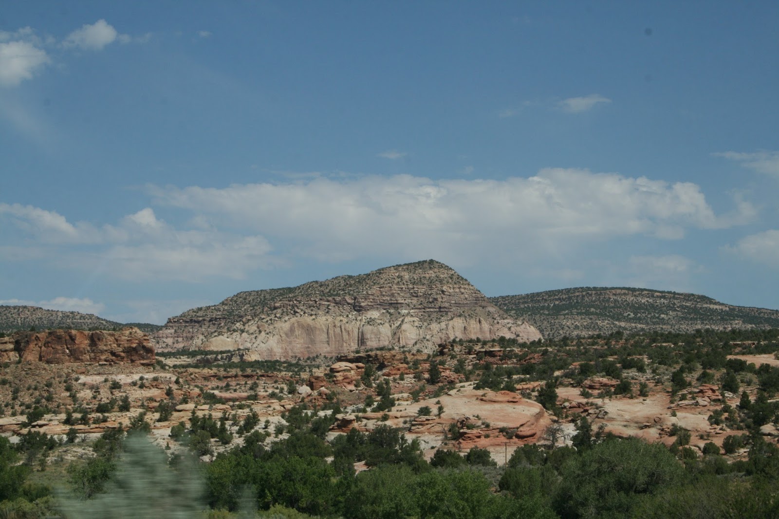
Vermilion Cliffs
The Vermilion Cliffs are made of deposited silt and desert dunes, cemented by infiltrated carbonates and intensely colored by red iron oxide.  Here’s what we saw as we drove through the valley.
The Colorado River cuts the valley floor.
This is what drew us to Vermilion Cliffs.

Did you know?
The Vermilion Cliffs are the second step in the five-step Grand Staircase of the Colorado Plateau.

The Grand Staircase refers to an immense sequence of sedimentary rock layers that stretch south from Bryce Canyon National Park and Grand-Staircase-Escalante National Monument, through the Zion and Grand Canyon National Parks.

The Campground
It's a bit like a big gravel parking lot, but there are trees and all of the services work very well.

Tonight
We had dinner at Big John's Texas BBQ (during half-time and part of the 3rd quarter) and watched Ohio State open the 2017 season by beating Indiana (49-21).

Tomorrow
We’re off to Escalante as we head for Capitol Reef National Park.

Wednesday, August 30, 2017

Day 24 – Towaoc, CO to Page, AZ

Wow!  Today displayed unusual terrain and included an intense storm.

The Route
We traveled 202 miles from Towaoc, CO to Page, AZ.  We started out by going southwest on US-160 toward the Four Corners, stopped at the Four Corners, continued west to AZ-98 and followed it north to Page.  We passed through unfamiliar places like Teec Nos Pos, Red Mesa, Mexican Water, Tes Nez Iah, Kayenta and Tsegi along the way.

About the Day
The day was full of surprises.  It started mostly sunny, breezy and pleasant.  The temperature reached the low-90s by early afternoon.  Then a squall hit.  It started to rain, the temperature dropped to 48° in about 10 minutes, and it began to hail.  A strong crosswind kept driving interesting.  Yikes!

The storm passed in 20 minutes.  The sun returned and the temperature reached 97° by the time we arrived in Page.

Getting Started
Heading for the Four Corners …
The desert along US-160
It sure looks barren
We saw a few small herds.
The last curve before the Four Corners
These horses seem to be
stuck on a steep hillside.

There was no way we were going to pass the Four Corners without stopping.  So, we stopped and Carol shopped.
We're here.
What a mall!  I can shop in four states.

On the Way
The terrain captured our attention all day.  Every mesa, butte, plateau, outcrop, and shape was different and interesting.  It seemed as though a giant had dropped toys on the desert floor.
Some samples ...
We're driving into the squall.
Lake Powell - approaching Page on AZ-98.

Did you know?
US-160 is called Trail of the Ancients.  The attractions we've seen while following it the past few days confirm the name .

Page was founded in 1957 as a housing community for the Glen Canyon Dam workers and their families.

The Campground
We’re staying at the Page-Lake Powell Campground for two nights.

Tomorrow
We want see Lake Powell, Glen Canyon Dam, Horseshoe Bend, and Vermillion Cliffs … and watch the Ohio State vs. Indiana football game.

Tuesday, August 29, 2017

Day 23 – Towaoc, CO (Day 2)

We visited the Hovenweep National Monument today.  It’s a part of the Canyons of the Ancients National Monuments … including Mesa Verde, Lowry Pueblo, and the Anasazi Heritage Center.

The Route
US-160 north to Cortez, followed the signs 42 miles to Hovenweep N.M., and then followed the signs back to Cortez.

About the Day
The day was mostly sunny, breezy and pleasant.  The temperature reached the mid-80s.

Getting Started
We visited for a while with a Class-A full-timer from Providence, RI.  He and his wife were heading eastward today.

Then we stopped by Kuchu’s Restaurant at the casino for a nice breakfast.  It was convenient and economical.

On the Way
The route to Hovenweep passed through an interesting and remote area.
Many ranches and farms lined the route.
The terrain was breathtaking.
There were some fixer-uppers.
How does this occur?
We're getting close.

Our return route remained on the mesa and offered some new sights.
We didn't travel on fancy roads.
We spotted this corral in the wilderness.
There were some large, well tended fields.

The Visitor Center
You don't come here by mistake.
Heading for the Little Ruin Trail
Visitor Center Grounds

The Towers of Hovenweep
We were able to view a collection of buildings clustered along Little Ruin Canyon.  Most of the 9 buildings were constructed from 1230 to 1275.  We got pictures of 6 of the buildings.

Stronghold House
Eroded Boulder House
Twin Towers
Rim Rock House
Tower Point
Tower Point from afar

Unit Type House

Did you know?
The Anasazi or Ancestral Puebloan culture was centered on the Four Corners area.  It flourished between AD 300 and 1300.

President Warren G. Harding proclaimed Hovenweep a national monument in 1923.

The Canyons of the Ancients National Monument was created in 2000.

 “Hovenweep” is Ute/Paiute for “deserted valley”.

Eye Catchers
We saw these just south of Cortez on US-160.
An interesting business.
Open?

The Campground
Scenes from the Ute Mountain Casino and Sleeping Ute Mountain RV Park
Site #25

Tomorrow
We’ll head west on US-160 toward Page, AZ.